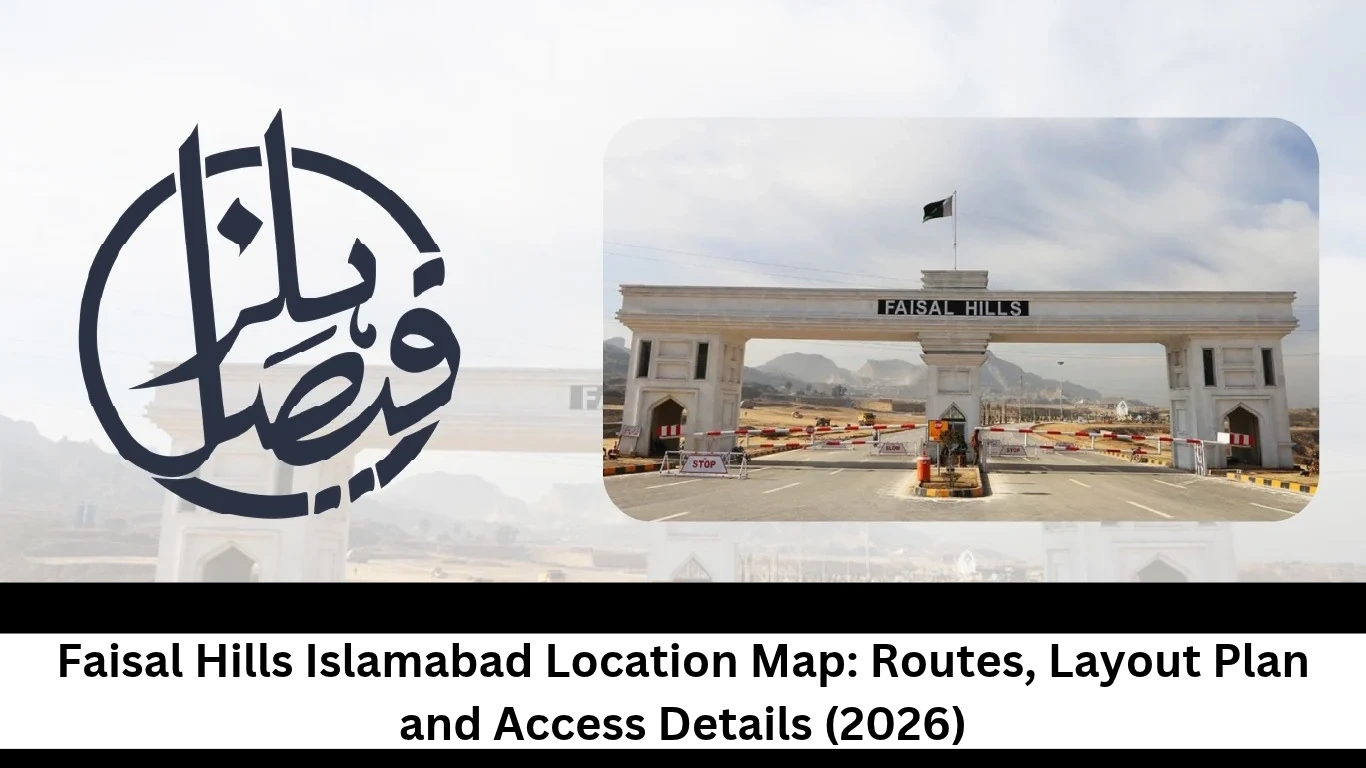
The Faisal Hills Map 2026 helps buyers understand the project’s location, block arrangement and access routes before selecting a plot. However, a dealer’s cropped map screenshot may not show where a particular block sits within the wider project. Knowing the difference between a location map, master plan and block map can help you check the information more carefully.
That’s the exact problem the Faisal Hills Map 2026 is supposed to solve, and it only works if you know which kind of map you’re looking at. A location map, a master plan and a block map aren’t the same thing. This guide breaks down each one, shows you how to check a map’s date and source, and walks you through verifying a single plot.
Where Is Faisal Hills Located?
Faisal Hills sits on the Main GT Road (N-5) in the Taxila region, right up against the Margalla Hills. Zedem International develops it, and the same portal places the project in the Taxila area of Rawalpindi District. A developer press release run by Tribune and ARY News says the project connects to Islamabad through Margalla Avenue.
So the broad picture is consistent. The label isn’t. Some listings write “Islamabad” in the address, others say Taxila, and a few say Rawalpindi. That gap matters more than it looks, and the next two sections explain why.
Faisal Hills Location in Relation to Islamabad and Taxila
Why does everyone search for “Islamabad”? Mostly because it’s in the project’s name. That’s branding. Where the land physically sits is one question, and which authority governs it is a completely separate one.
The sources I reviewed put the society near Taxila. One project profile on ProPakistani lists the Rawalpindi Development Authority as the approving authority. But that’s a property portal, not a government record, so this guide doesn’t claim Faisal Hills falls inside Islamabad’s boundary.
If jurisdiction matters to your decision, ask for the approval papers. The developer’s NOC page is a decent starting point, though it only shows what the developer chooses to publish. Confirm the final status with the relevant authority.
Understanding the Faisal Hills Taxila Map
A Faisal Hills Taxila Map is mostly useful for context. Open any standard map service and you can see how the society sits against Taxila, the GT Road corridor and the Margalla foothills. Market sites also list nearby landmarks such as HITEC University Taxila and the COMSATS campus in Wah Cantt. Cross-check any landmark on an independent map before you rely on it.
Here’s the catch. A map pin shows proximity, not legal boundaries. Dropping a pin near Taxila tells you nothing about which district or authority controls that land. Use it to orient yourself and leave it there.
The developer’s location page shows how the project presents its own position. Read it next to an independent map and note where the two disagree.
Faisal Hills Islamabad Map: Understanding the Main Access Routes
When using the Faisal Hills Map 2026 to check access routes, six questions help determine whether a route is usable.Where does it start? Which road or junction does it use? How does it reach the project? Is the access direct or indirect? Does the road exist yet, or is it only planned? And can people actually use it today?
Most sources agree that the project fronts the GT Road. After that, the evidence gets thin. Plenty of pages mention the M-1 Motorway, Srinagar Highway and Margalla Avenue, but they rarely say whether those links are direct, indirect or still on paper. Read each claim with that in mind.
Main Route Options for Reaching Faisal Hills
GT Road (N-5). This one has the strongest support. Independent listings and the developer’s own press material both describe the society as sitting on the Main GT Road near Taxila, as the Zameen area guide shows. Traffic from the Tarnol side and from Taxila both feed into this corridor. You’ll still need a current map to find the exact entrance.
M-1 Motorway. Market sites connect the society to the motorway, but they stay vague about how. One listing talks about planned future access to the CPEC route through the M-1. “Planned” and “future” are the key words there. They don’t describe a connection you can use today.
Margalla Avenue. The press release says the continued expansion of Margalla Avenue is expected to strengthen links to the M-1 and the airport. Notice the word “expected.” That’s a developer statement about the future, so don’t treat it as an open road.
Drive times differ too. One portal says about 20 minutes to the M-1, another says 22. Neither explains how it measured, so I haven’t repeated either number.
Which Route Should Buyers Check Before Visiting?
Start with your own starting point. Then make sure your destination pin matches the entrance you actually want, because the general society pin often drops you at the GT Road frontage while your block may sit behind a different internal road.
Ask the seller which entrance serves your block, and get the name of the connecting road. Then confirm the road is open right now. A line on a plan doesn’t mean you can drive on it.
I’d also skip words like “fastest” or “most convenient” unless you’ve tested the route yourself. Road conditions change, and most listings never say when they last checked.
Faisal Hills Master Plan: Overall Layout and Block Arrangement
The Faisal Hills Map 2026 includes an important distinction between the overall master plan and individual block layouts. Think of a master plan as the big picture. It shows how the whole project is arranged and helps you place a block in context. What it doesn’t do is prove that every marked road, park or building exists on the ground.
The plan has also changed over time. One older listing says the master plan covered four blocks: A, B, C and the Executive Block. The developer’s website now has separate pages for Block D and the Prime Block as well. That tells you the layout has grown, so an undated master plan can easily mislead you.
Open the developer’s master plan page and look for three things: a visible date, a revision mark, and a note on what the drawing covers.
What Information Does the Faisal Hills Master Plan Show?
Only describe what you can actually see on your copy. A typical plan might show block boundaries, main roads, residential and commercial zones, and parks. Many plans leave out individual plot numbers entirely. If yours does, you’ll need a block map to find a specific plot.
Be careful with labels, too. A road or park on a plan might be built, proposed or purely conceptual. Unless the document says otherwise, call it map-indicated. A commercial label means planned use, not a finished building.
How to Read the Master Plan Before Selecting a Plot
Work through it in this order. First, find your block’s name. Then see where it sits in the wider layout and trace the roads that link it to the entrance. Read the legend so you know what each symbol means, and note any parks or commercial strips nearby.
After that, check the plan’s date and who issued it. Compare it with the block map, and finally match your plot details against your own documents.
Most buyers skip the date check, and it’s the step that saves the most trouble. Keep in mind that a master plan helps you find your way around. It can’t confirm ownership, availability or possession.
Faisal Hills Block Map: Understanding Different Blocks
A block map zooms in on one slice of the master plan. It usually shows plot arrangement, internal roads and dimensions. If you want to find one specific plot, this is the document you need, because the master plan alone is too general.
Don’t assume every block has its own published map. Some may have a detailed file while others only appear inside the overall plan. If all you’ve got is the general plan, tell the seller and ask for the detailed version.
Block A, Block B, Block C and Block D Map Details
The developer publishes separate pages for Block A, Block B, Block C and Block D. Those pages show how the developer presents each block. They don’t prove that each block has a dated, detailed layout document behind it.
Market claims about the blocks vary as well. One portal profile says Block A has been sold out, while another listing calls Block C a luxury residential area expecting motorway access. Both are market claims. Neither tells you the current status of any block.
Never borrow details from one block to describe another. Road widths, plot sizes and facilities differ, so check every claim against the map for that exact block.
How Buyers Can Compare Individual Block Maps
Compare maps on equal terms. Look at block boundaries first, then road widths and plot numbering. After that, move on to plot dimensions, residential and commercial designations, and internal access.
Scale and orientation can trick you. Two maps may look different simply because one is zoomed in more or points north in another direction. A visual difference doesn’t prove the layout changed.
Before you decide something changed, compare each document’s date, source and coverage. If the dates differ, ask which version applies to your plot, and get that answer in writing.
Prime Block Map: Location, Layout and Access
A good Prime Block Map shows the block’s boundary, its internal roads and its plot arrangement, and it carries a source and a date. The developer presents the block on its Prime Block page. The sources I reviewed didn’t establish a publication or revision date for any Prime Block layout, so check your own copy for one.
Start with three quick questions. Does the map name the block clearly? Check whether it shows the block’s position within the wider project. Also, determine whether it lists individual plot numbers or displays only the block outline.
Without plot numbers, you’ll need a separate plot document.
Marketing often calls this block “premium.” That’s the developer’s word, and it doesn’t prove better access or facilities. For more background, the developer’s Prime Block overview post is worth reading, as long as you treat it as developer-stated material.
Faisal Hills Prime Block Location
The Faisal Hills Prime Block Location is only trustworthy if a dated map shows it. Without one, any claim about its exact position is a guess. Ask the seller to mark the block on the master plan and tell you where that plan came from.
If two maps place the block differently, don’t just pick the prettier one. Compare their dates, then ask the developer’s office which version is current.
What Buyers Should Verify on the Prime Block Map
Before you trust the document, look closely at a handful of details. Who issued it, and when? Where’s the block boundary? Do the plot number and dimensions match what the seller told you? Does the road sit where they said it would? If the map marks corner or park-facing plots, does your plot carry that label?
Last, does the map agree with the seller’s own paperwork? A marketing map can’t replace an allotment letter, a transfer record or an ownership document. Use the map to find the plot, and use the documents to prove it’s yours.
Faisal Hills Executive Block Map: Layout and Location Details
The Executive Block has been around longer than the newer blocks. One listing on Zameen describes it as an exclusive residential block beside the Margalla Hills with direct access from the main GT Road. That tells you how sellers pitch the block. It doesn’t tell you what a verified map shows.
The developer lists the block on its Executive Block page. The Faisal Hills Executive Block Map in your hands could be a dealer image, a screenshot or a developer file, so work out which before you trust it.
I couldn’t find a separate, dated Executive Block map in the sources I reviewed. If you can’t get one either, ask the seller in writing for the block boundary, the road link to the GT Road, the plot number and the plot dimensions. And don’t assume this block shares a layout or road network with any other.
Faisal Hills New Block: Map Identification and Verification
“New Block” is a confusing label. It could mean an official block, a recent extension, or just a name dealers use in ads. None of the sources I reviewed treats it as an official block name.
One market site does tag Block D with the phrase “New Block Launched,” as iReal Projects shows, and the developer’s website lists Block D on its own page. So some dealers probably use Faisal Hills New Block to mean Block D. That’s an inference, not a confirmed fact.
If a seller uses the term, ask for the exact block name in writing. Then ask which map shows its boundaries and when that map was issued. If they can’t answer, treat the label as unverified.
How to Download and Use the Faisal Hills Map PDF
Go to the original source first. The developer’s website is the best place to look for a layout file. If a file comes from a dealer or a portal, call it market-circulated until you can confirm where it started.
Once you have a PDF, look at the dates first. Then zoom in and make sure you can read the block labels, road markings and plot numbers. Check that it shows the full layout and not a cropped corner, and compare it with your plot documents.
Screenshots lose detail fast. They often chop off the date, the legend or the scale, so ask for the original file whenever a seller sends an image. Some portals also offer a download they call an approved layout. Treat that as a market claim unless an authority confirms it.
How to Check Whether a Map Is Updated
Start with the date on the document and the name of whoever issued it. Look for a revision number, then compare the boundaries with any other versions you can find. If roads or plot arrangements differ between versions, note exactly where. Finally, confirm your plot with the authorised office.
No date means you can’t judge whether a map is current. And if you find a newer-looking file online, you still can’t call it the latest. All you can say is that it’s the latest one you found.
How to Verify a Plot’s Location Using the Faisal Hills Map
The Faisal Hills Map 2026 can help identify a block, but knowing the block isn’t the same as verifying an individual plot. The block gives you the area. The plot number, dimensions and documents tell you whether that specific plot really exists where the seller says it does.
Here’s a process you can follow:
- Get the exact block name and plot number from the seller.
- Ask for the relevant block map.
- Find that block on the master plan.
- Match the plot number to the block map.
- Check the stated dimensions and road position.
- Compare everything with the allotment document.
- Review the transfer papers, if they apply.
- Ask the authorised office to settle any discrepancy.
- Visit the site where it makes sense.
Be wary of dealer-marked screenshots, cropped images and verbal directions. A random pin on a general location map doesn’t identify a plot either. The developer’s verification post explains its own checking process, and you should read it as developer-stated guidance.
Map Verification Versus Physical Site Verification
A map can show you a planned location and a plot arrangement. It can’t confirm who holds possession, what’s been built, what condition the roads are in, whether utilities exist, or who owns the plot. It also can’t prove the plot a seller shows you is the one in your paperwork.
A site visit answers other questions. You can see the road, the surroundings and the state of the land. But standing on a plot doesn’t prove you own it. Documents do that.
So neither check replaces the other, and you should do both. If handover is on your mind, the developer’s possession status post is a useful read, again as developer-stated material.
Common Mistakes Buyers Make When Reading Faisal Hills Maps
Most errors come from small shortcuts, and they’re easy to fix once you spot them.
- Treating an old map as the latest. Check the date before anything else.
- Mixing up a location map and a master plan. Ask what the document actually covers.
- Assuming every block has an official map. Ask where each one came from.
- Trusting a dealer’s marked screenshot. Request the original file.
- Confusing a block with a plot. Match the plot number on the block map.
- Assuming a planned road is open. Confirm it on site.
- Reading a map as proof of approval or ownership. Ask for the documents.
- Ignoring the gap between plan and reality. Compare the plan with what you see in person.
- Skipping scale and orientation. Read the legend and the north arrow.
- Comparing maps from different dates. Look at the revision details first.
None of this is unusual, and none of it is hard to avoid with a bit of patience.
What Should Buyers Confirm Before Relying on the Faisal Hills Map?
Run through this checklist before you act on any map. Who issued it? Does it cover the whole project or one block? Is there a publication or revision date you can see? Does the block name match your seller’s documents, and does your plot number appear on the right map? Are the dimensions clear?
Then look at the roads. Are the connecting ones existing, planned or unclear? Does the map match your other layout documents? Can the relevant office confirm where your plot sits, and has anyone explained the differences between the map and the site?
Written confirmation beats a verbal promise every time. If a seller won’t put an answer in writing, take that as a warning sign. And save the payment plan page for after your plot checks are done.
Final Overview of Faisal Hills Map 2026
The Faisal Hills Map 2026 helps most when you match it to the right question. The location map shows geography, the master plan shows the whole layout, and a block map shows how one block is arranged. None of them replaces your plot documents.
Prime Block and Executive Block details each need their own source checks, since a market description isn’t a map. Don’t assume “New Block” is an official name. And remember that dates and issuing sources decide how far you can trust any document.
Before you commit any money, get the right map, confirm the block and plot number, compare every document, and settle each discrepancy in writing.
Frequently Asked Questions About Faisal Hills Map 2026
Q1: Where is Faisal Hills located?
Ans: It sits on the Main GT Road (N-5) near Taxila, close to the Margalla Hills. Listings use both Islamabad and Taxila in the address.
Q2: Where can I find the Faisal Hills Map 2026?
Ans: Start with the developer’s website, then compare it with an independent map service. Check each file’s source, date and revision details. A newer-looking file isn’t automatically the latest version.
Q3: What does the Faisal Hills Master Plan show?
Ans: Usually the overall layout, the blocks, the main roads and marked areas. Not every plan includes plot numbers or every facility, so describe only what your copy displays.
Q4: How can I find the Prime Block Map?
Ans: Check the developer’s Prime Block page first. Then confirm the file’s source, date, block boundaries and plot information. If a seller only sent a screenshot, ask for the original.
Q5: Is the Faisal Hills Executive Block Map available separately?
Ans: The developer lists the block on its website, but I couldn’t confirm a separate, dated map for it. Ask the seller or the developer’s office for the original file in writing.
Q6: How can I check a plot’s location on the map?
Ans: Match the block name and plot number to the block map. Then compare the dimensions and road position with your allotment or transfer documents. If anything doesn’t line up, ask the authorised office to resolve it.